Sunscreen in the Morning, Umbrellas by Night: Phoenix Faces a Rainy Shift
A Dynamic Start to the Week
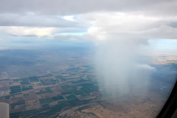
Phoenix residents should prepare for a split-personality weather day this Monday, March 9, 2026. While the morning begins with the classic Valley sunshine, a low-pressure system moving through the Southwest is expected to bring a significant shift in conditions by nightfall. The transition from record-approaching warmth to late-day showers will define the start of the work week.
Morning Conditions: Fair and Mild
The day is set to begin on a pleasant note. Temperatures at daybreak will hover around 59°F to 62°F. Skies will remain mostly clear with fair conditions, making it an ideal time for outdoor commutes or early morning exercise. Winds during the early hours will be light and variable, primarily coming from the north and west at less than 5 mph. Visibility remains excellent, providing a crisp start to the morning for Valley drivers.
Afternoon Peak: Warmth Before the Clouds
As the sun climbs, the temperature will reach a projected high of 82°F by mid-afternoon. This temperature is notably higher than the historical average of 76°F for this date. However, the warmth will be accompanied by an increase in cloud cover starting around 2:00 PM. Humidity levels, which typically bottom out at 24% in the afternoon, will begin to climb as moisture flows into the region. The UV index is expected to hit a level 6 (High), so sun protection is recommended for anyone spending time outdoors during the lunch hour.
Evening and Night: Showers Arrive
The most significant weather changes will occur after sunset. Meteorological models indicate a 70% chance of rain beginning in the late evening. We are expecting occasional rain showers and potentially a few isolated thunderstorms that could deposit roughly a quarter of an inch of precipitation across the metropolitan area. Winds will shift to the West-Northwest, increasing to speeds of 5 to 10 mph with occasional higher gusts as the front moves through. The temperature will descend to an overnight low of 59°F.
Safety and Travel Advice
- Slick Roads: Commuters should be cautious during the late evening and early Tuesday morning. Rain hitting dry desert roads can create especially slippery conditions.
- Outdoor Plans: While the afternoon is dry, move any evening activities indoors to avoid the 70% chance of showers.
- Hydration: Despite the evening rain, the afternoon high of 82°F requires staying hydrated if you are active outdoors.
Looking ahead, tomorrow is expected to be cooler as the rain clears, leaving behind refreshed desert air and more seasonal temperatures.
Phoenix Canal Death Identified as Alex Fleming; Authorities Say No Link to Missing Nancy Guthrie

Phoenix police investigate fatal hit-and-run after pedestrian struck near 21st Avenue and Indian School Road

Long TSA wait times raise planning challenges for Phoenix Sky Harbor travelers during peak departures