Showers and Storms: A Damp Tuesday Ahead for the Valley of the Sun
Tuesday Morning: A Mild and Clear Start
Early risers in Phoenix are greeted with relatively calm and clear conditions this morning. As the day begins, the air remains crisp with temperatures hovering near the daily low of 56°F. Humidity levels are currently peaking at approximately 56 percent, a common morning trend for this time of year before the desert sun begins to dry out the atmosphere. While the skies appear largely unobstructed for the morning commute, residents should enjoy the sunshine while it lasts, as a significant shift in the weather pattern is already underway according to the latest data from the National Weather Service.
Afternoon Outlook: Rising Temperatures and Brewing Storms
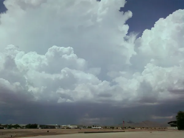
Expect temperatures to reach a seasonal peak of roughly 78°F by the mid-afternoon hours. However, the primary weather story for the later part of the day involves a steady increase in moisture and atmospheric instability. Regional forecasters have indicated that chances for showers and isolated thunderstorms will rise sharply as the afternoon progresses. The focus of this activity is expected to be most concentrated toward the south and east of the Phoenix metropolitan area. While the central parts of the city may see scattered clouds initially, the rapid development of isolated storm cells could lead to quick changes in local visibility and road conditions, especially for those commuting through the East Valley.
Evening and Overnight: Lingering Rain and Cooler Air
As the sun sets, the potential for precipitation is expected to persist across the region. Forecast models suggest that the activity developing this afternoon will likely continue through the evening and into the overnight hours. Temperatures will gradually retreat back toward the mid-50s, making for a damp and cool night for the Valley. For those with outdoor evening plans, it is highly recommended to have a light jacket and an umbrella ready. The relative humidity, which typically drops to about 24 percent in the dry afternoon heat, is expected to remain uncharacteristically high throughout the night due to the influx of moisture and scattered rainfall.
Wind and Precipitation Analysis
Total rainfall for this Tuesday is projected to be as high as 0.53 inches in specific areas that encounter the core of the passing storm cells. While many parts of the Valley will observe generally light rainfall amounts, the National Weather Service warns that locally heavier downpours are possible within the more active thunderstorms. In terms of wind, residents should prepare for a breezy day with average speeds hovering around 10.6 mph. While no formal wind warnings have been issued, the proximity of isolated thunderstorms can often trigger sudden, gusty conditions and localized dust. Looking ahead, this rainy spell is expected to be short-lived, as a rapid warming trend is forecast to bring much hotter temperatures to the region by the end of the week.